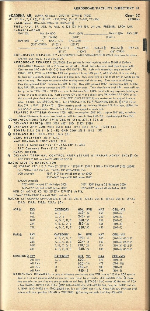
The Enroute Supplement was part of the DOD Flight Information Publications (known as FLIP). It, along with the IFR charts (Low and High Altitude) and Approach Charts (Hight and Low Altitude) contained all the information you needed to fly into an airfields in the area. The Pacific version had yellow covers and were updated every few months. Some bases kept them on the airplane while others kept them in the squadron in bags made just for them. It was a necessity to have them onboard. Usually three copies of each were provided (for the Aircraft Commander, Copilot, and Navigator) and took up considerable room on the flight deck.


The main part of the Enroute Supplement was detailed information on airfields throughout the Pacific area. Aphabeticaly arranged, you could look up a base you have never been to and find out the runway length, type of surface, heading, frequencies for communications and navigation, etc. Very helpful.


There was a section for diagrams of airfields starting on page 213. Handy if you were unfamiliar with the area.


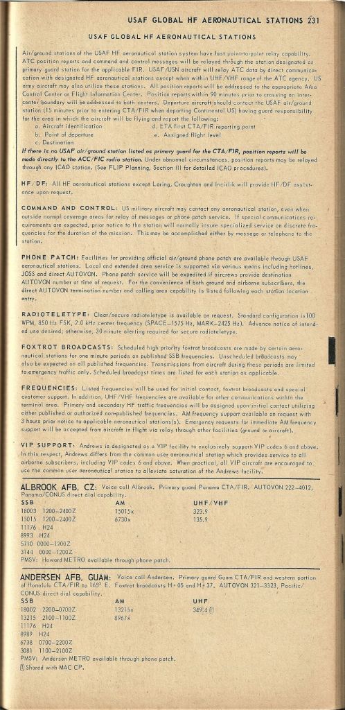
On pages 231-233 was the names and HF frequencies of the USAF HF stations that would provide long range communications with US military aircraft. Better know as XXX Airways, they were an important partner with airlift resources in the Pacific. Although they were not an actual Air Traffic Controll facility, they would act as a liaison between aircraft and the appropriate ATC center. For example, if you were sitting On Marcus Island, a 1000 miles from Yokota, an aircraft could contact Yokota Airways on and HF frequency and they would obtain your IFR clearance from Tokyo Center and pass it on to you. They would also connect you with the command post, weather shop, the squadron, etc via phone patches. And there were the famous SKY KING, SKY KING, SKY KING, DO NOT ANSWER, DO NOT ANSWER Alpha Lima Papa Hotel ….and so on. These were coded messages to the airborne SAC B52s. You had to be careful what you said as the Russians, Chinese, and any one else could listen in on your conversations. The lower ranges of the HF frequency were also some CB channels, sometimes you could raise some CB people.


On page 246-7 was an illustration of military Ground Control Intercept (GCI) sites throughout the western Pacific. These were run by either the host country or the USAF. They would provide radar monitoring if requested and they were not busy in their primary duty of vectoring fighters to “enemy” aircraft.

And there was a section on procedures for specific areas. For exampe, below is the information you need to contact Saigon for the position of the latest artillery firings or airstrikes. Could be dangerous to fly through an active artillery barrage. Several aircraft have be lost to it.

Information on flying into Tan Son Nhut.
